Fall Photo Guide · 2026
Find fall color in its best light.
Typical peak dates, sunrise angles and local weather for 188 researched overlooks, parks and trails.
The national picture
Use the date slider to follow typical color changes across the US.
- No change
- First color
- Approaching peak
- Peak
- Past peak
- Bare
- Outside model range
Latitude and elevation estimates; actual timing may vary by weeks. Colors apply where deciduous trees grow.
Map sources & limitations
Terrain: Mapzen Terrain Tiles, with USGS 3DEP, SRTM and GMTED2010 elevation data. Our seasonal model estimates timing from latitude and elevation; it does not incorporate this year's weather, tree species or forest cover. Fine terrain detail does not imply forecast precision. Neutral areas fall outside the model's 30–49°N range.
Alaska uses a separate regional timing estimate and is inset at 0.29× scale. Washington, DC and Hawaii have their own guides. How the timing model works · Calculated 2026-09-17.
Through Andy’s lens
Meet the photographerPlaces worth a closer look, photographed by Andy Feliciotti.
-
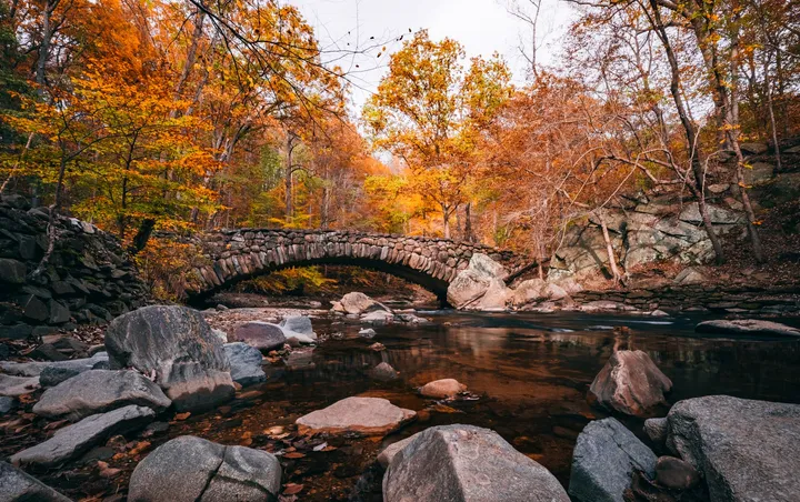
Boulder Bridge, Washington, D.C. · Archive photograph · © Andy Feliciotti Boulder Bridge, Rock Creek Park
- Typical peak
- Oct 18 – Oct 26
- Plan for
- Overcast light
-
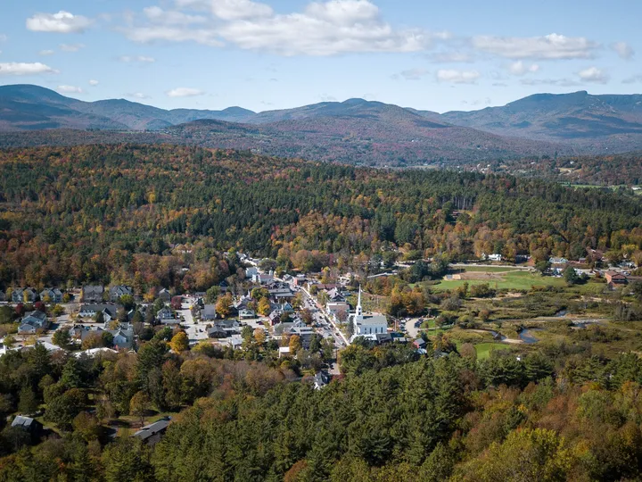
Stowe, Vermont · Archive photograph · © Andy Feliciotti Stowe Community Church
- Typical peak
- Oct 2 – Oct 10
- Plan for
- Sunrise or sunset
Typical seasonal windows. Source: seasonal timing model; local weather can shift peak.
Seasonal model estimate. Timing remains uncertain; check recent reports before traveling. Source: seasonal timing model. Calculated .
Typical peak now
6 states are in the typical peak window at reference elevation.
- Montana Peak
Typical peak Sep 15
- Wyoming Peak
Typical peak Sep 16
- Washington Peak
Typical peak Sep 17
- Idaho Peak
Typical peak Sep 18
- Colorado Peak
Typical peak Sep 20
- South Dakota Peak
Typical peak Sep 21
Turning next
- Idaho Sawtooth aspen peaks late September; Panhandle larch in late October. Sep 14 – Sep 22 Peak
- Colorado Above 10,000 ft peaks in mid-September; the 8,000-ft valleys follow in early October. Sep 16 – Sep 24 Peak
- South Dakota The Black Hills peak late September to mid-October; the eastern prairie in mid-October. Sep 17 – Sep 25 Peak
- Utah The high Wasatch peaks late September; the canyons and Zion in mid-to-late October. Sep 19 – Sep 27 Approaching peak
- North Dakota Late September into the first week of October, statewide. Sep 20 – Sep 28 Approaching peak
- Nevada High aspen peaks late September to early October. Sep 20 – Sep 28 Approaching peak
Typical peak this week
Higher elevations often reach peak before nearby valleys.
- Kenosha Pass Peak
Front Range, CO · 9,984 ft
The Colorado Trail crosses the highway here and runs straight into a dense aspen stand, with South Park opening below to the southwest. Backlit trunks in the first half mile of trail are why Denver photographers arrive before six.
- Oxbow Bend Peak
Grand Teton National Park, WY · 6,755 ft
Mount Moran rises nearly 6,000 feet above a slack bend of the Snake River, with aspen and cottonwood packed along the far bank. Windless mornings hold the reflection, and moose working the willow flats turn up in the same frame.
- Redfish Lake Peak
Sawtooth National Recreation Area, ID · 6,547 ft
Grand Mogul and Mount Heyburn close the southwest end of the lake, and aspen stands near the lodge and along Redfish Lake Creek supply the yellow. Shoot from the boat-launch beach at first light while the water is still flat.
- Stanley Lake Peak
Sawtooth National Recreation Area, ID · 6,513 ft
McGown Peak stands off the west end of the lake and reflects the whole way across on a calm morning. Aspen and cottonwood along the inlet and the Stanley Lake Creek bottom lay a yellow band at the base of the peak.
- Holland Falls Trail Peak
Swan Valley, MT · 4,290 ft
The trail traverses the north shore a few hundred feet above the water, and at the falls you turn around to a view west down the full length of Holland Lake with larch stacked on both sidewalls. Late October strips the cottonwood and leaves the larch alone against dark fir.
- Kebler Pass Peak
West Elk Mountains, CO · 10,007 ft
The road runs 30 miles through one of the largest aspen stands in North America, with white trunks packed against the Ruby Range and Marcellina Mountain. Flat overcast light saturates the leaves and removes the contrast that ruins midday frames in this forest.
From people who were there
Report what you sawPlan the photograph
Check the timing and light before choosing a location.
How the forecast works · 188 locations researched
-
Timing by elevation
Compare ridge and valley peak dates before choosing an overlook.
-
Sun angle for your date
Check sunrise time and direction for the date you plan to shoot.
-
Wind and fog
Check the local wind forecast and fog estimate before planning reflections or a dawn shoot.
-
Forecast uncertainty
Typical dates help with planning; recent reports help you judge whether color has arrived.