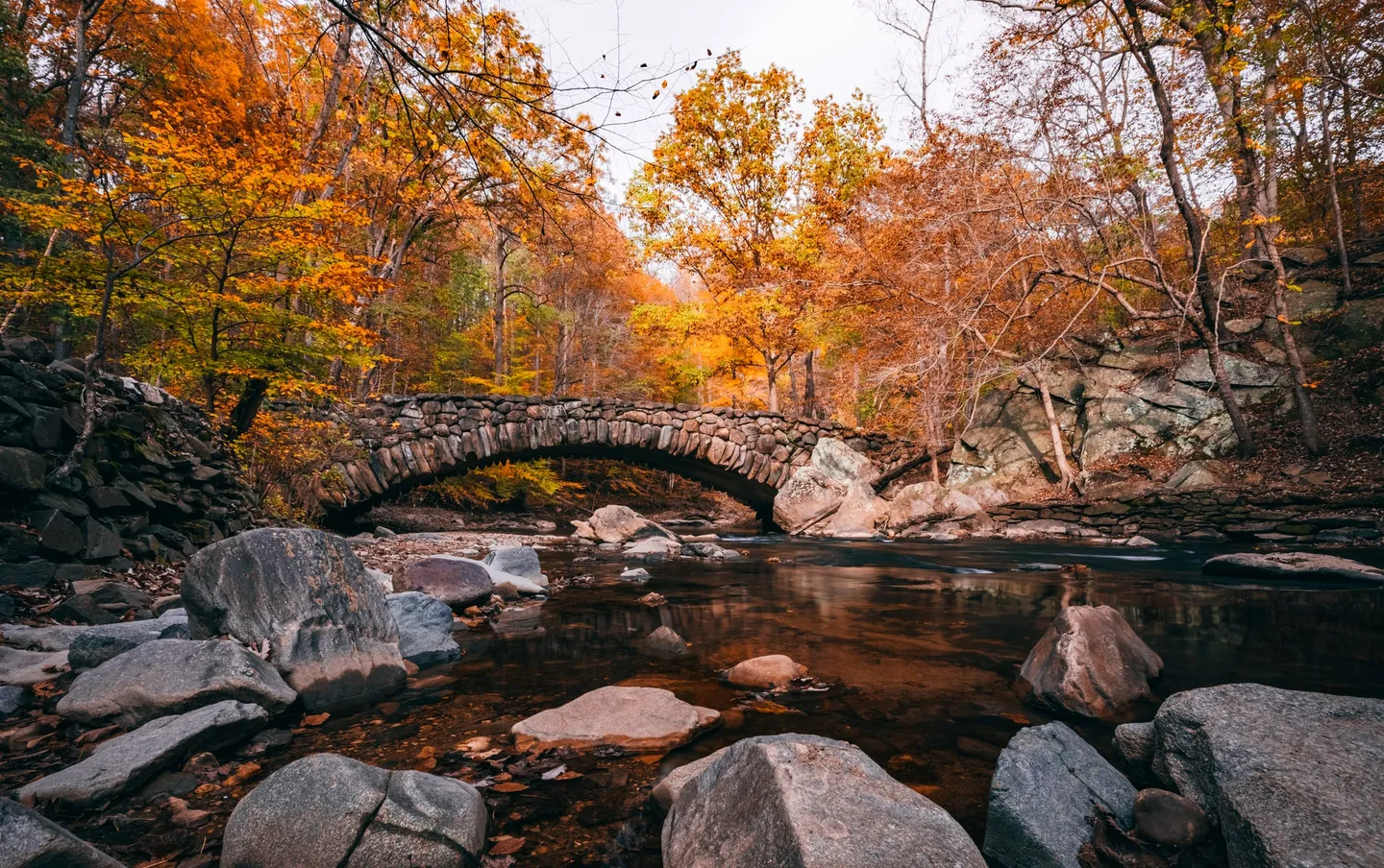
Boulder Bridge, Rock Creek Park
Rock Creek Park, Washington, D.C. · 71 ft
Typical peak
Oct 18 – Oct 26
moderate confidence in typical timing.
Best light
Best under flat overcast
A 1902 arch of unmortared fieldstone carrying Beach Drive over Rock Creek, sunk in a tulip poplar and beech ravine. Flat cloud keeps the boulders and the water dark, which is the only way the yellow canopy above them holds saturation.
Seasonal model estimate. Timing remains uncertain; check recent reports before traveling. Source: seasonal timing model. Calculated .
Crowds
moderate
Often busier by mid-morning; consider arriving at first light.
Getting there
Beach Drive north of Broad Branch closes to cars on weekends. Park at the Rapids Bridge lot off Ross Drive and walk up the creek about half a mile.
What turns here
- tulip poplar
- american beech
- northern red oak
- sycamore
Color progression
Typical peak Oct 22Typical color progression for Boulder Bridge, Rock Creek Park. No change from Sep 14 to Oct 1. First color from Oct 1 to Oct 10. Approaching peak from Oct 10 to Oct 18. Peak from Oct 18 to Oct 26. Past peak from Oct 26 to Nov 5. Bare from Nov 5 to Nov 19.
Boulder Bridge, Rock Creek Park is typically at past peak on Nov 1, 2026.
This season so far
First frost
None yet
No night at or below 32°F since Aug 1.
Last 14 days
66°F / 45°F
Average daily high and low.
Modeled weather for these coordinates from the Open-Meteo historical archive, Aug 1 – Oct 31; not a station record. Reported peak is the median date of approved peak-color reports.
Plan the light
Boulder Bridge, Rock Creek Park on October 22, 2026, the center of its typical peak window.
| Event | Time |
|---|---|
| First light (blue hour) Sun 6° below horizon | 6:57 AM |
| Sunrise Rises ESE · 103° | 7:24 AM |
| Morning golden hour ends 37 min of low, warm light | 8:01 AM |
| Solar noon Highest sun, flattest light | 12:52 PM |
| Evening golden hour starts 37 min before sunset | 5:44 PM |
| Sunset Sets WSW · 256° | 6:20 PM |
| Last light (blue hour) Sun 6° below horizon | 6:47 PM |
Times in America/New York · day length 10h 56m · computed from NOAA solar equations.
Local terrain can hide the sun; allow extra time to reach your viewpoint.
Which way to point the camera
Sun rises ESE, sets WSW.
Aim within 45° of the sun for translucent leaves. Turn your back to it for flat, accurate color.
Shooting conditions
Glassy water, wind blur, and what the cloud will do to your light.
Recent reports
What people actually saw here. Been recently? Add yours.
Nearby locations
Within 100 miles in a straight line; road distances can be longer.
- Theodore Roosevelt Island Past peak
Washington, D.C. · 4 mi away
38 ft · peaks Oct 23 - Tidal Basin Past peak
Washington, D.C. · 4 mi away
10 ft · peaks Oct 23 - U.S. National Arboretum Past peak
Washington, D.C. · 5 mi away
53 ft · peaks Oct 23 - Chimney Rock, Catoctin Mountain Bare
Maryland · 51 mi away
1,395 ft · peaks Oct 16